
British Isles LIDAR Topographic
- نوع فایل : نرم افزار
- زبان : انگلیسی
- سال تولید : 2016
Description
Format: OBJ, 3ds Max, FBX (.obj, .max, .fbx)
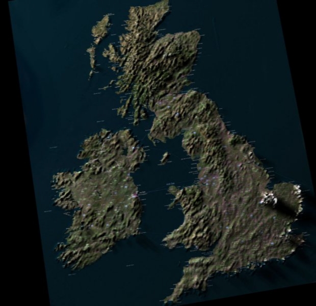
LIDAR ALSM topographic map of the British Isles with Earthstar diffuse map.
135K faces, urban centres highlighted, 7000x5164 height map included
Geometry
Polygon Mesh
Polygons
0
Vertices
0
Textures
No
Materials
No
Rigged
No
Animated
No
3D Printable Ready
No
Game Ready (low poly)
No
UV Mapped
No
Unwrapped UVs
Unknown
TAGS
terrain
terraform
united
kingdom
great
britain
ireland
wales
scotland
isles
archipelago
jersey
gurnsey
shetland
orkney
lidar
aslm
satellite
uk
islands
british
england
anglo
monarch
commonwealth
geographic
britannia
gaelic
celtic
atlantic
channel
