
Avenza Geographic Imager for Adobe Photoshop v5.2
جی گرافیک ایمیج فور ادوبی فتوشاپ
- کاربرد : نرم افزار کار با تصاویر ماهواره ای برای ویندوز
- نسخه :Version 5.20
- نوع فایل : نرم افزار
- زبان : انگلیسی
- سیستم عامل : Windows 32Bit & 64Bit
- تولید کننده : Avenza Systems
- سال تولید : 2017
توضیحات
برنامه ای کاربردی و جدید برای کار بر روی تصاویر شطرنجی و تصاویر فضایی به صورت سریع و کارآمد و بدون پیچیدگی میباشد. این نرم افزار دارای ابزارهای لازم برای ورود و ویرایش، دستکاری تصاویر صادراتی مکانی مانند هوایی، تصاویر ماهواره ای و .. میباشد. شما با استفاده از توابع این نرم افزار مانند شفافیت، فیلتر، ویرایش پیکسل، و تنظیمات تصویر مانند روشنایی، کنتراست، و کنترل منحنی با حفظ مرجع فضایی در نرم افزار Avenza Geographic Imager، قابلیت ویرایش تصاویر را دارید.
قابلیت های کلیدی نرم افزار Avenza Geographic Imager for Adobe Photoshop:
- امکان ویرایش تصاویر شطرنجی
- قابلیت تنظیم تصویر با حفظ مرجع فضایی
- امکان ویرایش سریع تصاویر فضایی
- ویرایش تصاویر صادراتی مکانی
- و...
اما وجه تمایز Avenza Geographic Imager for Adobe Photoshop نسبت به سایر نرم افزارهای مشابه در چیست؟
ابزارهای متنوع ارائه شده در این نرم افزار به شما کمک می کند تا با استفاده از توابع مختلف بتوانید تنظیمات و توابع مختلفی را روی تصویر خود اعمال کنید و در سریعترین زمان ممکن بتوانید تغییرات مورد نیاز خود را روی تصویر اعمال کنید.
Description
Working with raster imagery doesn't have to be complicated. Geographic Imager mapping software enhances Adobe Photoshop to make working with spatial imagery quick and efficient. It adds tools to import, edit, manipulate and export geospatial images such as aerial and satellite imagery. Enjoy the use of native Adobe Photoshop functions such as transparencies, filters, pixel editing, and image adjustments like brightness, contrast, and curve controls while maintaining spatial referencing.
Feature Highlights
Georeference images easily by adding ground control points. Manually add control points, import or export points from a text file, and view accuracy and errors. Use the Quick Georeference option to make georeferencing even easier. Multiple transformation types are supported.
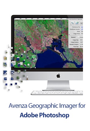
Geographic Imager Panel
Redesigned for Adobe Photoshop CS5, the Geographic Imager? panel provides access to all the tools and functions quickly and easily. All spatial information related to a GeoTIFF, DEM, ECW, MrSID or other supported image including the co-ordinate system, world location of the corners and pixel size are displayed along with buttons to access the various Geographic Imager functions. More time is left to edit geospatial data rather than searching for tools.
Retain Spatial Properties
Geographic Imager allows the use of Adobe Photoshop native functionality without destroying the spatial properties of a GeoTIFF, DEM, ECW, MrSID or other spatial image. Easily manipulate and adjust the visual elements such as colour values and levels, histograms, hues and sharpness. Spatial properties of the image are automatically updated and retained even after performing crop, rotate or geospatial adjustments. This is important in industries such as photogrammetry and remote sensing where it is necessary for analysis.
Import and Export Spatial Imagery
improved . Import and manage georeferenced imagery in Adobe Photoshop such as GeoTIFF, NITF, PCI and other compatible raster data formats, including support for CIR, RGBI and other multispectral and multichannel data. Advanced Import allows you to crop images during the import process (before they are opened), making it a great way to crop large images.
Geospatial PDF support
Create Adobe Acrobat PDF files containing coordinate systems from Geographic Imager image or import and modify existing Geospatial PDF documents. Easily share or publish them online. Find locations, measure distances, perimeters and areas, add locations markers and customize export settings. Take the geospatial PDF maps on the go using the PDF Maps iOS app.
Import Elevation Data
Import DEM formats such as ArcInfo ASCII Grid, ArcInfo Binary Grid, USGS DEM ASCII/CDED, Military Elevation Data/DTED and SRTM. Assign a DEM Schema during import for easier rendering. Overlay aerial photography to create custom looking images.
Terrain Shader
Create shaded relief maps from DEM data in Adobe Photoshop quickly and easily using the Terrain Shader feature. Control intensity and lighting source. Define elevation intervals for custom colour ramps.
Georeference Imagery
Import or add ground control points for accurate georeferencing of aerial photography or satellite imagery with multiple transformation types supported. Assess residual errors to improve geoferencing and save control point data as reference files. Quick Georeference by a single tie point, two tie points, or from other documents.
Feature Highlights
Georeference images easily by adding ground control points. Manually add control points, import or export points from a text file, and view accuracy and errors. Use the Quick Georeference option to make georeferencing even easier. Multiple transformation types are supported.
Geographic Imager Panel
Redesigned for Adobe Photoshop CS5, the Geographic Imager? panel provides access to all the tools and functions quickly and easily. All spatial information related to a GeoTIFF, DEM, ECW, MrSID or other supported image including the co-ordinate system, world location of the corners and pixel size are displayed along with buttons to access the various Geographic Imager functions. More time is left to edit geospatial data rather than searching for tools.
Retain Spatial Properties
Geographic Imager allows the use of Adobe Photoshop native functionality without destroying the spatial properties of a GeoTIFF, DEM, ECW, MrSID or other spatial image. Easily manipulate and adjust the visual elements such as colour values and levels, histograms, hues and sharpness. Spatial properties of the image are automatically updated and retained even after performing crop, rotate or geospatial adjustments. This is important in industries such as photogrammetry and remote sensing where it is necessary for analysis.
Import and Export Spatial Imagery
improved . Import and manage georeferenced imagery in Adobe Photoshop such as GeoTIFF, NITF, PCI and other compatible raster data formats, including support for CIR, RGBI and other multispectral and multichannel data. Advanced Import allows you to crop images during the import process (before they are opened), making it a great way to crop large images.
Geospatial PDF support
Create Adobe Acrobat PDF files containing coordinate systems from Geographic Imager image or import and modify existing Geospatial PDF documents. Easily share or publish them online. Find locations, measure distances, perimeters and areas, add locations markers and customize export settings. Take the geospatial PDF maps on the go using the PDF Maps iOS app.
Import Elevation Data
Import DEM formats such as ArcInfo ASCII Grid, ArcInfo Binary Grid, USGS DEM ASCII/CDED, Military Elevation Data/DTED and SRTM. Assign a DEM Schema during import for easier rendering. Overlay aerial photography to create custom looking images.
Terrain Shader
Create shaded relief maps from DEM data in Adobe Photoshop quickly and easily using the Terrain Shader feature. Control intensity and lighting source. Define elevation intervals for custom colour ramps.
Georeference Imagery
Import or add ground control points for accurate georeferencing of aerial photography or satellite imagery with multiple transformation types supported. Assess residual errors to improve geoferencing and save control point data as reference files. Quick Georeference by a single tie point, two tie points, or from other documents.
1. Install 2. Copy the dll to "C:\Program Files\Adobe\Adobe Photoshop CC 2015" (or whichever version you have installed) 3. Put the license file to "C:\ProgramData\Avenza\Geographic Imager" NJoy!!
