
Geopainting GPSMapEdit v2.1.78.8 Build 15
جیوپیتینگ جی پی اس
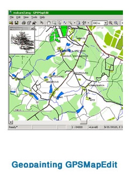
- کاربرد : نرم افزار ساخت , ویرایش نقشه های GPS
- نسخه :Version 2.1.78.8
- نوع فایل : نرم افزار
- زبان : انگلیسی
- سیستم عامل : Windows 32Bit & 64Bit
- تولید کننده : Pocket PC
- سال تولید : 2017
توضیحات
GPSMapEdit نام نرم افزاری می باشد که به کمک آن کاربران قادر خواهند بود تا نقشه های مربوط به سیستم ها و دستگاه های GPS را تهیه و ویرایش نمایند. این نرم افزار با قرار دادن ابزارهای مربوطه در اختیار کاربر این قابلیت را به آنان می دهد که در ایجاد یک نقشه مربوط به این سیستم از یک منظقه به راحتی عمل نمایند. در این نرم افزار کاربران علاوه بر این که می توانند نقشه های مربوط به دستگاه های دستی GPS را ایجاد نمایند ، می توانند نقشه های سازگار با گوشی های تلفن همراه از جمله Pocket PC ها را نیز ایجاد نمایند. این نرم افزار محصولی از شرکت Geopainting می باشد.
Description
New feature: The attributes of Polish format "Label2" and "Label3" are supported for maps with type set "Garmin". The attributes are loadable also from Garmin IMG format.
Enhancement: GUI localization for Japanese (beta-version based on automatic translation) is added. The localization for Persian is enhanced (thanks to Reza Amyari). Transliteration tables for Japanese kanas and for Persian to Latin is added.
Names of Garmin types in Polish language are fixed (thanks to Alf/red/).
Enhancement: Confirmation message is provided before deleting objects (thanks to Sergey Shetsko).
The confirmation may be turned off using the menu item 'Tools | Options...', "Edit" tab, checkbox "Confirm deleting objects".
Enhancement: In the window "Object Properties", the tab "Comment" is added; the field "Comment" is removed from the "Properties" tab.
Enhancement: In the window "Object Properties", the tab "Extras" is enhanced (adding, removing and editing of separate attributes is now supported).
Enhancement: In the window "Map Properties", the tab "Extras" is enhanced.
Fix: In the tool "Create Object | Polygon" and "Polygon: Strip", inserting a last point of contour now does not require cursor shifting (thanks to sersenk).
Enhancement: In the tool "Select Objects", sticking to neighbours is now applied to dragged POIs and bookmarks (thanks to Vladimir).
Enhancement: In the GPS protocol NMEA-0183, the sentences with the prefix "GN" are supported (the mixed mode GLONASS + GPS) (thanks to Alexey Rodionov).
Enhancement: Numbering along roads may be edited for maps with type set "Navitel". Being exported to .NM2 format, these numbers are automatically converted to hidden addressable points with type 0x2800.
Fix: Crash while exporting of some of maps into the format NM2 for Navitel 3.2.6 (thanks to Igor A. Sichev, autostavrroute, Albert Semenov).
Fix: Crash while loading some of files "gmapsup2.img" (thanks to Dmitry Kurochka).
Fix: Crash while creation of new polygons due to out of memory (thanks to Albert Semenov, Monstria).
Install -use "Serial Number.exe" for Serial Number :)
